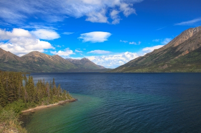
![Greenery (Richie Diesterheft) [flickr.com] CC BY-SA
License Information available under 'Proof of Image Sources'](/wp-content/uploads/reiseziele/55876Saba Panorama.jpg "Greenery (Richie Diesterheft) [flickr.com] CC BY-SA
License Information available under 'Proof of Image Sources'")
Furthermore, we analyzed all climate data and provide a recommendation about which months are best to visit Saba for your holiday.
Climate Overview
 23 °C to 31 °C
 26 °C to 29 °C
Show temperatures in degree
Geographical location
Table of Contents
Saba is a small island in the Caribbean. It has just under 2000 inhabitants. Saba was one of the Netherlands Antilles, which was raised in 2010, and now belongs to the Windward Islands, which in turn form part of the Lesser Antilles.
The nearest neighbouring island is Sint Eustatius, about 19 miles south-east of the Caribbean Sea. St. Kitts and Nevis is about 31 miles away in the same direction, St. Barth is also 31 miles away in northeast direction, the same applies to St. Maarten.
Climate on Saba
![Saba, from La Plage, Maho, St Maarten, Oct 2014 (alljengi) [flickr.com] CC BY-SA
License Information available under 'Proof of Image Sources'](/wp-content/uploads/reiseziele/saba-from-la-plage-maho-st-maarten-oct-201473971.jpg) Saba has the typical Caribbean climate, where it is very warm all year round and the temperatures fluctuate only slightly. In the summer months (June – September) average temperatures of 28 °C are reached, in winter it is still 26 °C. Also the fluctuations of the temperature during the day are small, even in winter it is usually still above 20 °C at night.
Saba has the typical Caribbean climate, where it is very warm all year round and the temperatures fluctuate only slightly. In the summer months (June – September) average temperatures of 28 °C are reached, in winter it is still 26 °C. Also the fluctuations of the temperature during the day are small, even in winter it is usually still above 20 °C at night.
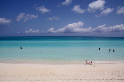
The water temperatures also vary between 26 °C and 29 °C. Please note, however, that there is no beach on Saba where you can swim.
So the weather is very nice and pleasant all year round, with an average of 8 to 9 hours of sunshine per day.
When to go to Saba?
Saba is a holiday destination that can be visited all year round. As it can get very warm in summer for European standards, we recommend the winter, spring and autumn months as the best travel season, because it is then at least a little cooler.
Highlights of the island
Saba is best known for its airport, Juancho E. Yrausquin Airport. It is home to the world’s shortest commercially used runway, which is only 400 metres long. No long-haul aircraft land on Saba, only small propeller aircraft of the airline Winair, which take off from the neighbouring Caribbean islands.
Saba is a volcanic island. Mount Scenery volcano can be climbed on a climbing path (which consists of over 1000 steps and takes about 90 minutes) and offers beautiful views over the island and the Caribbean Sea as a reward at the two peaks. Saba belongs to the Kingdom of the Netherlands and Mount Scenery is thus officially the highest elevation of the entire Netherlands.
Beach Vacation in February

Best Time to Visit Saba: Overview
JanuaryJan Best time to traveltime PerfectPerf. climate in The Bottom | FebruaryFeb Best time to traveltime PerfectPerf. climate in The Bottom | MarchMar Best time to traveltime PerfectPerf. climate in The Bottom | AprilApr Best time to traveltime PerfectPerf. climate in The Bottom | MayMay Best time to traveltime PerfectPerf. climate in The Bottom | JuneJun Very hot (average up to 28 °C) |
JulyJul Very hot (average up to 28 °C) | AugustAug Very hot (average up to 29 °C) | SeptemberSep Very hot (average up to 28 °C) | OctoberOct Best time to traveltime PerfectPerf. climate in The Bottom | NovemberNov Best time to traveltime PerfectPerf. climate in The Bottom | DecemberDec Best time to traveltime PerfectPerf. climate in The Bottom |
Climate Chart Saba
The Bottom

Show temperatures in degree
Source of Data: German Weather Service (Offenbach) and Wikipedia
Climate Table Saba
In the following, you will find the climate table for Saba, containing information about Temperatures, Precipitation, Water Temperatures, and Hours of Sunshine.Temperatures, Sunshine in The Bottom (Saba)
| Jan | Feb | Mar | Apr | May | Jun | Jul | Aug | Sep | Oct | Nov | Dec | |
|---|---|---|---|---|---|---|---|---|---|---|---|---|
| Day Temperature | 29° | 29° | 29° | 30° | 30° | 31° | 31° | 31° | 31° | 31° | 30° | 29° |
| Night Temperature | 23° | 23° | 24° | 24° | 24° | 25° | 25° | 26° | 25° | 24° | 23° | 23° |
| Water Temperature | 26° | 26° | 27° | 27° | 27° | 28° | 28° | 28° | 29° | 28° | 28° | 27° |
| Hours of Sunshine | 8 | 9 | 9 | 8 | 8 | 8 | 9 | 8 | 8 | 8 | 8 | 8 |
Show temperatures in degree
Temperatures
The annual average temperature in The Bottom is 27.1 °C.For comparison: London 11 °C, NYC 12 °C, LA 17.9 °C
Warmest month: August (28.5 °C)
Coldest month: January (26 °C)
The maximum water temperature in The Bottom is 29 °C. You can take a bath at these temperatures.
Months with water temperature of at least 21 °C (adequate for beach vacation):
all months
Sunshine
As our climate table shows, February is the sunniest month with an average of 9 hours of sunshine per day. Over the year, there are 8.3 hours of sunshine per day on average. For comparison: London has 4.1, NYC has 7 and LA has 8.9 hours of sunshine per day on average.Current Weather and Forecast
Current Weather in The Bottom
Clouds: 3 % Wind: 20 mph O
Air Pressure: 1016 hPa Humidity: 78 %
Air Pressure: 1016 hPa Humidity: 78 %
Last updated: 7th Feb 2023, 09:36 am
The next days …
| 7th Feb 2023 | 8th Feb 2023 | 9th Feb 2023 | 10th Feb 2023 | 11th Feb 2023 | 12th Feb 2023 |
|---|---|---|---|---|---|
| 23 °C to 23 °C | 23 °C to 23 °C | 23 °C to 23 °C | 23 °C to 23 °C | 23 °C to 23 °C | 23 °C to 23 °C |
| Clouds: 0 % | Clouds: 4 % | Clouds: 10 % | Clouds: 3 % | Clouds: 14 % | Clouds: 1 % |
| 0.04 in of rain | 0.06 in of rain | 0.04 in of rain | 0.05 in of rain | 0.05 in of rain | 0.02 in of rain |
Weather information provided by OpenWeatherMap. (CC BY-SA)
Show temperatures in degree
Caribbean: Regions
Saba is part of the holiday destination Caribbean. We analyzed the climate for additional regions, in order to provide you with information about the best time to visit and the expected holiday weather:Caribbean | Aruba | Curaçao | Bonaire | Trinidad and Tobago | Grenada | St. Vincent and The Grenadines | Barbados | St. Lucia | Martinique | Dominica | Guadeloupe | Montserrat | Antigua and Barbuda | Saint Kitts and Nevis | Sint Eustatius | Sint Maarten | Saint-Barthélemy | Anguilla | British Virgin Islands | United States Virgin Islands | Puerto Rico | Dominican Republic | Haiti | Turks and Caicos Islands | Jamaica | Cuba | Bahamas | Cayman Islands |
Best Time to Travel for the Regions
The Bottom: all except June, July, August, and September
Hottest Month
 June: 31 °C
Day Temperature in The Bottom
June: 31 °CDay Temperature in The Bottom
Coldest Month
 January: 23 °C
Night Temperature in The Bottom
January: 23 °CNight Temperature in The Bottom
Maximum Water Temperature
September: 29 °C
Water Temperature in The Bottom
September: 29 °CWater Temperature in The Bottom
Sunniest Month
 February: 9 hours/day
Sunshine in The Bottom
February: 9 hours/daySunshine in The Bottom
Distances to Saba
| London | New York | Los Angeles | |
|---|---|---|---|
| The Bottom | 4130 mi | 1720 mi | 3570 mi |
Where’s Saba?
Show The Bottom on MapContinent: North America
All Holiday Destinations in North AmericaShare your Experience and Win
We want to know: how was the weather during your Saba holiday? You can win a travel coupon of 1000 $. The price will be raffled among all submissions.

![Saba Runway (killians_red) [flickr.com] CC BY
License Information available under 'Proof of Image Sources'](/wp-content/uploads/reiseziele/saba-runway22823.jpg)
![Windwardside, Saba (Richie Diesterheft) [flickr.com] CC BY-SA
License Information available under 'Proof of Image Sources'](/wp-content/uploads/reiseziele/windwardside-saba8690.jpg)
![The view (Christine Warner Hawks) [flickr.com] CC BY
License Information available under 'Proof of Image Sources'](/wp-content/uploads/reiseziele/the-view50482.jpg)